Upgraded global terrain rendering map effect, true publication effect
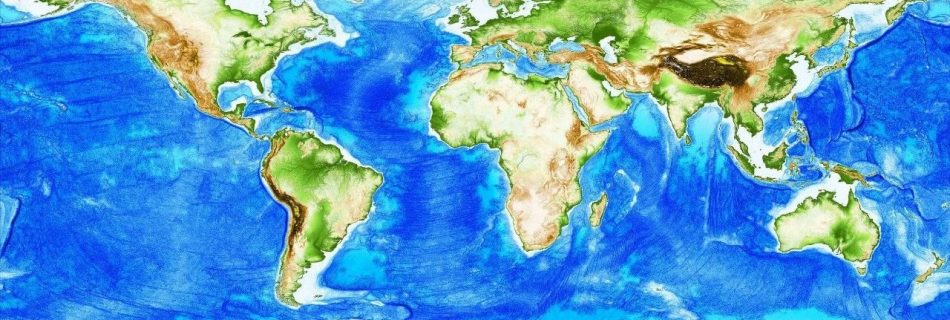
使用 ArcGIS Pro全球范围地形渲染图效果进一步升级,更换数据源,优化以往的表达错误!
使用 ArcGIS Pro全球范围地形渲染图效果进一步升级,更换数据源,优化以往的表达错误!

GIS's hottest tool is updated again!

Enterprise Gismaker Revolutionizing Reality Mapping: Transforming Dongguan City Gis 3D with DJI's Aerial Mapping Solution Unleashing the Power of Reality Mapping in China's Megacity In the realm of reality mapping, where authenticity meets innovation, the applications are boundless. Imagine a world where digital cities, urban planning, traffic management, public safety, and even life planning find …

Keywords: GIS, US 2020 election, accessing election data, utilizing election data,democratic The availability and utilization of GIS data have revolutionized the way we analyze and understand the US 2020 election. By leveraging geospatial information, researchers, policymakers, and campaign strategists can gain valuable insights into voter behavior, electoral patterns, and demographic trends. Accessing and effectively utilizing …